You can’t trust sewage or drainage pipes….They’re full of crap.
You would think that following the major flooding of our Thurles streets, last Sundays night; which saw 73.2mm to 125mm [3 to 5 ins] of sewage, permeated with surface water, flooding business premises and other dwellings, that those who raised our property taxes by 10% each year for the next two years, would have cleaned out our blocked drains.
No, five days later, total failure, I regret to report; as pictured by our drone this morning within the 50 kilometre [30mph] speed limit area, between O’Carroll’s (Top Oil) Service Station and Thurles Lidl Supermarket, on the N62, Slievenamon Road in the town.
[Pic. G. Willoughby]
The N62 road is a national secondary road linking the M6 motorway east of Athlone, Co. Westmeath with the M7 motorway south of Roscrea and junction 6 of the M8 motorway close to the Horse and Jockey in Co. Tipperary.
The N62 is well travelled daily by local councillors; Municipal District senior officials and staff.
Because of heavy traffic, our “eye in the sky” was only able to hover over, and photograph just two of some 5 identified blocked drains, all within a 500 meter stretch of this secondary road.
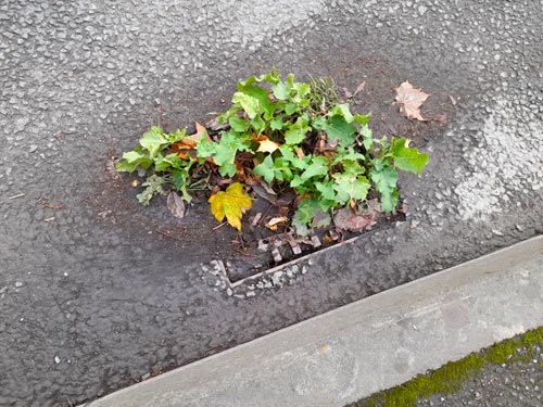
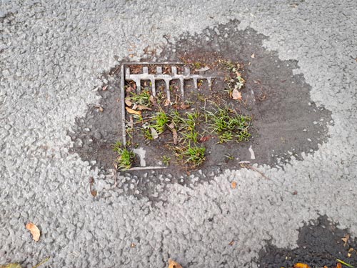
Clue to locating blocked drains.
Since, hopefully, you are driving within the 50 kilometre [30mph] speed limit laid down in this area, recently prone to flooding, it is easy to locate the blocked drains.
[Pic. G. Willoughby]
First check for tall Grass; various sprouting Brassicas; (latter genera of plants relatives of the cabbage and mustard family), Dandelines, frost tolerant Common Groundsel and germinating Wheat seed.
Same growth can be located growing, like tiny islands, on tarmacadamed road surfaces, usually located close to kerbs; growing from what appear to be at first potholes.
Here also is yet another clue; Thurles potholes (which we are aware number 3,978, following a more recent count by the Central Statistics Office) are for some unknown reason, usually round, disk shaped, or hoop-shaped on our Tipperary roads. Blocked drains on the other hand, for some strange reason and for the most part are quadrate or rectangular in shape.
Same are used everywhere else in Ireland, except Thurles town, to drain away excess rain and ground water from impervious surfaces, such as paved or tarmacked streets, car parks, parking lots, footpaths, side-walks, and roofs of buildings.
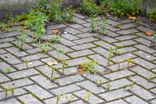
But then Thurles is big into promoting biodiversity, as can be seen by the state of our polluted river Suir, our pavements and our local graveyards.
[Pic. G. Willoughby]
Once identified, one wonders should Thurles Municipal District Council contact Irish Water; or the Office of Public Works; or maybe Iascach Intíre Éireann (Inland Fisheries Ireland)?
Maybe there is some other government department that Thurles Local Councillors can blame befort shifting responsibility.

Leave a Reply